Ćuprija
 |
The Romans founded the town as a fort Horreum Margi (Horreum: Granary, Margi: Morava) on the road from Constantinople to Rome, where it crosses the river now known as Velika Morava. It served as a Roman military base, had a shield factory and gained the status of municipium before AD 224. In 505, the Romans were defeated by Goths and Huns under Mundo, a descendant of Attila the Hun.
Under Slavic rule, it became known as Ravno (literal translation to English would be "flat"), since it is in a flat river valley. Some local names (of the villages Paljane and Isakovo, of the river Mirosava) recall the major clash in autumn 1191 between the Serbs (under Stefan Nemanja) and the Byzantines (under Emperor Isaac II Angelos).
In the 15th century, Ćuprija became part of Ottoman Empire. After conquering this settlement, the Turks built a bridge or "köprü" in Turkish – hence the name of the town. Shortly after the First Serbian Uprising began, in 1805 one of the first and most important battles was won by Ivankovac, near Ćuprija. Serbian uprisers under the leadership of dukes Milenko Stojković, Petar Dobrnjac, and Stevan Sinđelić defeated a Turkish army which led to further spreading of the Uprising through all of Belgrade Pashaluk. Four years after that, in 1809, Ćuprija Elementary school was founded.
During the Second Serbian Uprising, Serbian prince Miloš Obrenović made an oral agreement in Ćuprija which enabled Serbs in Belgrade Pashaluk to collect their own taxes, to participate in proceedings against Serbs and to establish a National Office composed of Serbian princes. After 1834, the town started to grow economically and eventually merged with the nearby villages of Mućava, Mrčajevci, and Žirovnica. In the Ottoman era, Ćuprija was the town of Smederevo with the highest concentration of Albanians. Contemporary Serb author Joakim Vujić recorded more "Turkish Arnauts than Serbs" in 1826 in the town. After the war, Obrenović began a campaign to buy out all Muslim Albanian households in the town. In 1853, "Dobričevo" farm was founded. This led to the establishment of the Agricultural school in 1899. In 1911, a Sugar factory called "ŠELK 911" was founded.
During the 19th century, Ćuprija was the center of Nahiyah. After 1890, it was the seat of Morvaski okrug (Morava County).
From 1929 to 1941, Ćuprija was part of the Morava Banovina of the Kingdom of Yugoslavia.
In World War Two, a special Ćuprija-Paraćin partisan troop was formed in order to fight against the German Wehrmacht. On September 26, 1941, 35 members of this troop were shot by German occupiers. The Second World War finally ended in Ćuprija on October 13, 1944, when town was liberated from the Wehrmacht during the so-called Belgrade Operation.
During the NATO bombing of Yugoslavia in 1999, the town's center was heavily damaged. Some buildings still remain in ruins. As of 2011 census, the municipality has 30,645 inhabitants.
Map - Ćuprija
Map
Country - Serbia
 |
 |
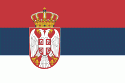
| Flag of Serbia | |
Continuously inhabited since the Paleolithic Age, the territory of modern-day Serbia faced Slavic migrations in the 6th century, establishing several regional states in the early Middle Ages at times recognised as tributaries to the Byzantine, Frankish and Hungarian kingdoms. The Serbian Kingdom obtained recognition by the Holy See and Constantinople in 1217, reaching its territorial apex in 1346 as the Serbian Empire. By the mid-16th century, the Ottomans annexed the entirety of modern-day Serbia; their rule was at times interrupted by the Habsburg Empire, which began expanding towards Central Serbia from the end of the 17th century while maintaining a foothold in Vojvodina. In the early 19th century, the Serbian Revolution established the nation-state as the region's first constitutional monarchy, which subsequently expanded its territory. Following casualties in World War I, and the subsequent unification of the former Habsburg crownland of Vojvodina with Serbia, the country co-founded Yugoslavia with other South Slavic nations, which would exist in various political formations until the Yugoslav Wars of the 1990s. During the breakup of Yugoslavia, Serbia formed a union with Montenegro, which was peacefully dissolved in 2006, restoring Serbia's independence as a sovereign state for the first time since 1918. In 2008, representatives of the Assembly of Kosovo unilaterally declared independence, with mixed responses from the international community while Serbia continues to claim it as part of its own sovereign territory.
Currency / Language
| ISO | Currency | Symbol | Significant figures |
|---|---|---|---|
| RSD | Serbian dinar | дин or din. | 2 |
| ISO | Language |
|---|---|
| BS | Bosnian language |
| HU | Hungarian language |
| SR | Serbian language |


